Maps show the changes at Kibboth Crew
Maps have been invaluable in our research of the dig site as they show the outline of the mill and lodge and indicate when changes took place.
1842 & 50 The mill building was irregular shape
The lodge or reservoir was in 2 parts, joined by stream or channel

1893 Surveyed in 1891

The building had been enlarged & become rectangular
The lodge was enlarged, squarer in shape and a dam can be seen
Two small buildings had been built on the south edge of site
A larger building had been built at north of site
The chimney appeared for the first time on this map.
In March 1894 the reservoir burst and a woman was killed and the next available map surveyed in 1908 shows that the mill had disappeared. The Ramsbottom Observer and Bury Times reported that “the building which stood between the two bottom lodges had fallen”. This must have been at the dig site.
1910 Surveyed in 1908
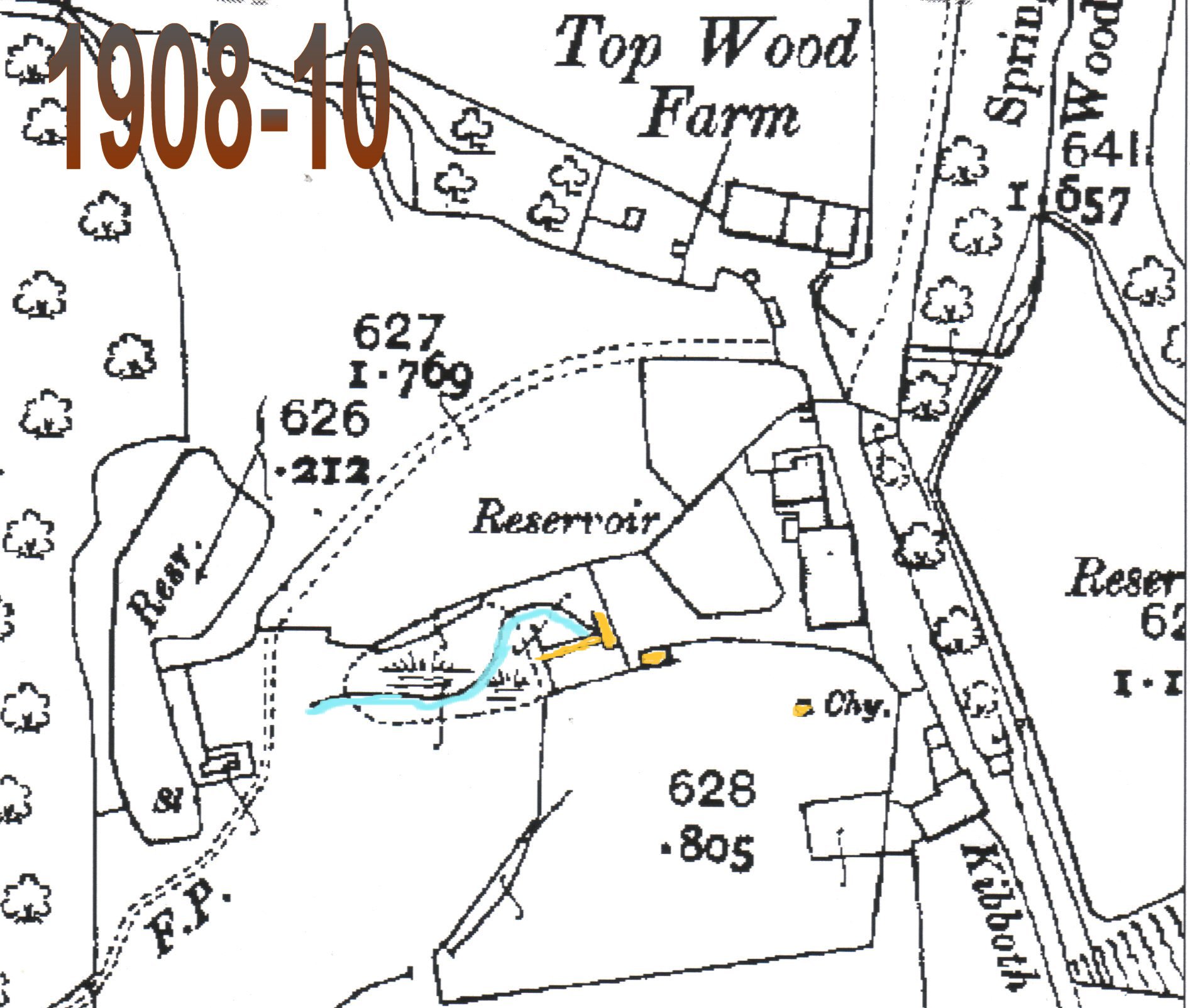
The Mill building and lodge had disappeared
The dam now incomplete & the stream flowed north of the wheel pit
The wheel pit was still there
What appears to be the stone arch was still there
Only one of the buildings on the south side remained
The building on the north side had disappeared
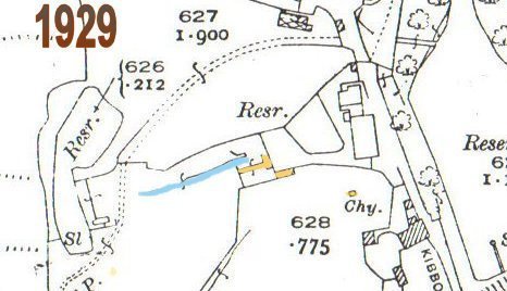
1929 & 1938 No changes from the previous map
1962
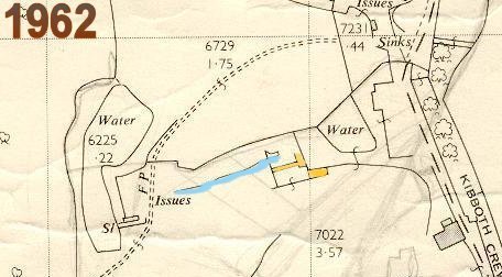
The small building on the south side was drawn in outline only.
It probably had no roof, as other buildings on the map are shaded
The chimney had disappeared