
Read it at home and enjoy the videos, watch the videos and then go for a walk or just enjoy the walks.
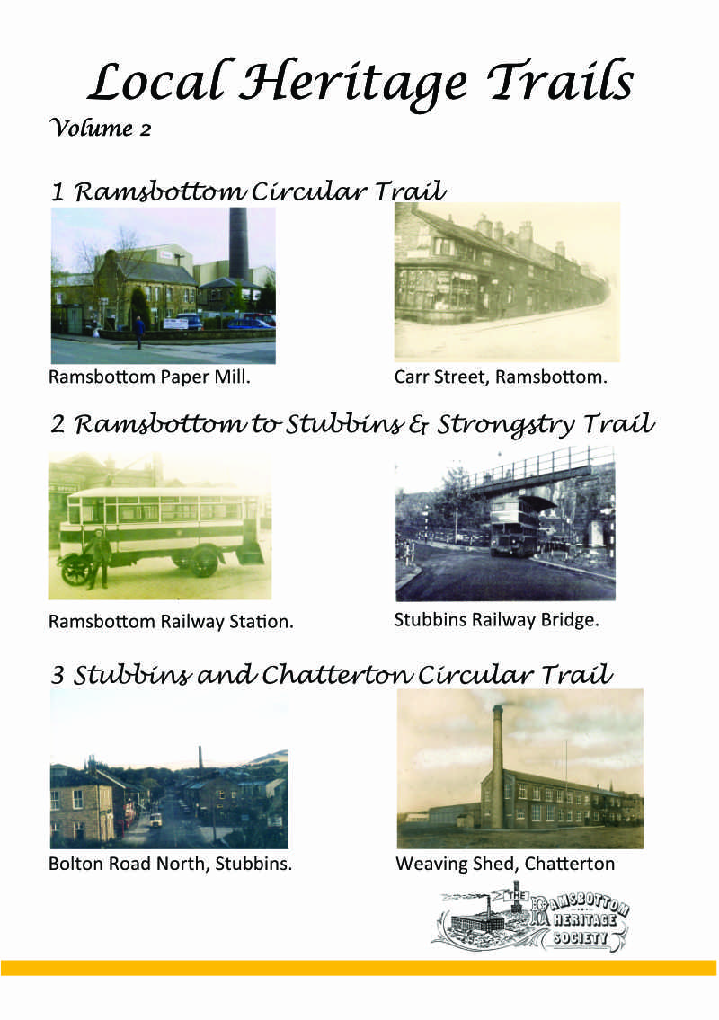
Volume 2 has 3 guided walks and includes 40 pages of photographs old and new, four maps, descriptions of buildings that you will pass and 25 QR codes that link to videos on some of the buildings.
This is divided up into three walks:
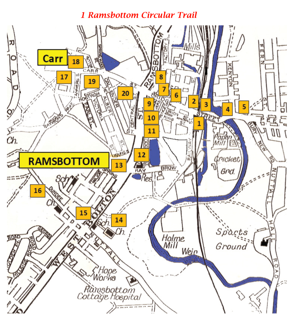
Walk 1 is from Ramsbottom Station, Bridge Street Gardens, Hearth of the Rams, back up Bridge Street, Wesleyan Chapel Market Place, Bolton Street, Dundee Lane, Tanners Street, Carr Street, Grant Arms Market Place and back to Ramsbottom Station. It is 3.4 Km (2.1 miles) longg and should take a couple of hours. It is on roads, with an incline up Dundee Lane.
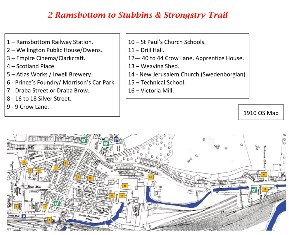
Walk 2 is from Ramsbottom Railways Station, Railway Street, Irwell Street, Scotland Place, Morrisons Car Park, Draba Brow, Silver Street, Crow Lane, Factory Street, Stubbins Lane, Stubbins Street, Strongstry and then back along Stubbins Street, Stubbins Lane, Factory Street, Paradise Street, Bridge Street and Ramsbottom Station. It is 5 km ( 3 miles) long and will take about an hour and a half to complete. It is on roads and flat.
Walk 3 is Stubbins Railway Station, Bolton Road North, Croft End Mill, Chatterton Road, St. Philips Church, Peace Playing Fields, Old Chatterton Old Road, Edenwood Mill, Bolton Road North and back to the start. Start anyhere on the trail, there is a small carpark at Chatterton or park on Bolton Road North. The trail is 2.7km (1.8 miles) and will take around an hour. It is on roads.


